| State Route 275 | ||||
|---|---|---|---|---|
| Route information | ||||
| Maintained by Caltrans | ||||
| Length: | 2.074 mi[1] (3.338 km) (before 2001 and 2006 relinquishments) |
|||
| History: | State highway in 1910; became US 40/99W in 1928-29, I-80 in 1964, and SR 275 in 1967 | |||
| Section 1 | ||||
| West end: | I-80 Bus. / US 50 in West Sacramento | |||
| East end: | Garden Street in West Sacramento | |||
| Section 2 | ||||
| West end: | 3rd Street in West Sacramento | |||
| East end: | Neasham Circle in Sacramento | |||
| Highway system | ||||
|
State highways in California(list • pre-1964)
|
||||
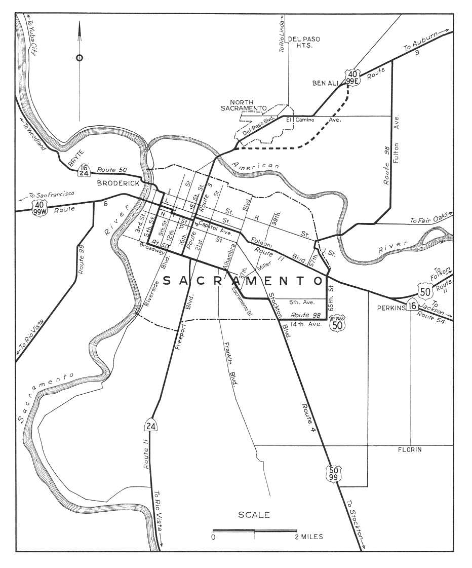
State Route 275 (SR 275) is a short unsigned state highway in the Sacramento area of the U.S. state of California. The highway, also known as Tower Bridge Gateway (formerly West Sacramento Freeway), is a short spur from Interstate 80 Business / U.S. Route 50 in West Sacramento over the Tower Bridge into downtown Sacramento. Despite its deletion from the Streets and Highways Code in 1996, the California Department of Transportation (Caltrans) still maintains about half of the route; approximately 1/2 mile (1 km) was relinquished to West Sacramento in 2001 and about the same (along Capitol Mall) to Sacramento in 2006. (Similarly, State Route 160 is still a state highway north of the American River in Sacramento, but the legislative description ends at the south city limits.) West Sacramento completed a project to replace the freeway with a pedestrian-friendly street.
Contents |
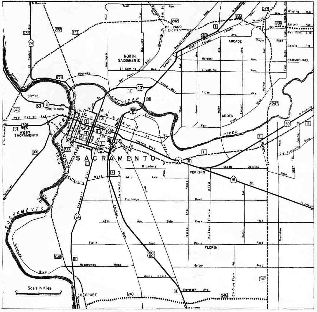
The West Sacramento Freeway begins on Interstate 80 at exit 81 (West Capitol Avenue), the east end of the Yolo Causeway. It soon splits, with I-80 exiting to bypass Sacramento to the north and Interstate 80 Business (legislatively U.S. Route 50) continuing east via exit 82 towards downtown. After one interchange, at Harbor Boulevard (exit 1/1B), the freeway splits again, with Bus. 80 turning abruptly southeast over the Pioneer Memorial Bridge to avoid downtown Sacramento. State Route 275 begins here, at exit 3 of Bus. 80, with full access to and from the intersecting Jefferson Boulevard (State Route 84).[2]
State maintenance ends just after the Jefferson Boulevard interchange, and the road — now maintained by the city of West Sacramento as Tower Bridge Gateway — crosses the new Garden Street at an at-grade intersection. This intersection replaced a partial trumpet interchange, oriented towards West Capitol Avenue with a missing westbound entrance, in 2007. After Tower Bridge Gateway crosses under the Union Pacific Railroad line that used to cross the Tower Bridge, it approaches an intersection with 5th Street. It was formerly a ramp that entered the westbound lanes from the intersection of West Capitol Avenue and 5th Street, which completed the former interchange at Riske Lane. Two blocks to the east, Tower Bridge Gateway approaches its final intersection in West Sacramento with 3rd Street. A westbound offramp formerly lead to West Capitol Avenue and 3rd Street, with eastbound access to Broderick to the north and the formerly industrial area to the south, now containing Raley Field.[2]
State maintenance resumes once again as SR 275 crosses the Sacramento River on the Tower Bridge, a four-lane lift bridge that formerly carried a Sacramento Northern Railroad track in the center. At the east end of the bridge, the roadway becomes Capitol Mall, maintained by the city of Sacramento, and crosses over Interstate 5. Seven blocks later, the main road ends at 9th Street; the last block of Capitol Mall to 10th Street, on which the State Capitol fronts, is a two-lane road with a mid-block traffic circle around a fountain.[2]
SR 275 began as part of Legislative Route 6, one of the shorter main routes of the initial system funded by the 1910 bond issue. This highway, which included the several-mile-long Yolo Causeway, connected Sacramento with the north–south Route 7 at Davis, thereby linking the capital city with the San Francisco Bay Area. Route 6 traffic initially left Sacramento on the 1911 I Street Bridge, heading southwest through the small settlement of Washington via D Street, 5th Street, and present Tower Court to West Capitol Avenue.[3][4] The state highway was moved to the M Street Bridge in 1926, as part of an improvement that also took it through a two-lane subway under the Sacramento Northern Railroad, still present on West Capitol Avenue.[5] The M Street Bridge was replaced by the Tower Bridge in 1935.[6]
U.S. Routes 40 and 99 (soon 99W) were marked along Route 6 in 1928.[7] These two routes remained on West Capitol Avenue[8] until 1954, when the new West Sacramento Freeway opened, connecting the west end of the Tower Bridge with the east end of the Yolo Causeway. Traveler-oriented businesses along the bypassed West Capitol Avenue were hit hard by the shifting of through traffic.[9]
The entire freeway was designated as part of Interstate 80 in the late 1950s. However, two bypasses were planned — a realignment of Route 6 that would take I-80 over a new bridge and around the south side of downtown, and a northern bypass of the entire city (I-880).[10] Since the southerly bypass had not been completed in time for the 1964 renumbering, the route over the Tower Bridge — and along downtown streets — became Route 80,[11] but US 99W signage remained (initially following Capitol Mall to near the State Capitol, later turning south onto 3rd and 5th Streets east of the bridge)[12][13] until the late 1960s,[14] before I-5 had finished replacing old US 99W north of Woodland.[15]
Normally, upon completion of the new I-80 south of downtown, the old alignment over the Tower Bridge and through downtown would be relinquished. The legislature recognized that it might be useful to keep a state highway to the Capitol, and so in 1966 it passed a concurrent resolution requesting that the California Highway Commission delay relinquishment west of 9th Street until the last day of the 1967 legislative session.[16] During that session, a new Route 275 was created from that portion of former Route 80. This consisted of the eastern part of the West Sacramento Freeway, the Tower Bridge, and Capitol Mall up to 9th Street, just west of the capitol building. The portion in Sacramento, east of the bridge, was not to be beautified with state highway funds.[17] Due to the cancellation of a replacement of the North Sacramento Freeway, I-80 was moved to former I-880 around the city in 1981, giving the West Sacramento Freeway three numbers: I-80, US 50, and SR 275.[18]
In 1993, the West Sacramento City Council approved the "Triangle Specific Plan" for a new downtown in the triangle bounded by the Sacramento River, SR 275, and US 50;[19] this plan included downgrading the freeway to a surface road.[20] The state legislature passed a law in 1994 that allowed Caltrans to come to an agreement with West Sacramento or Sacramento for the relinquishment of any part of SR 275.[21] Although no portions had yet been relinquished, the legislature deleted Route 275 from the Streets and Highways Code in 1996.[22]
The Triangle redevelopment happened slowly, with the first part — Raley Field — opening in 2000.[20] Effective January 1, 2001, Caltrans relinquished SR 275 to West Sacramento between postmiles 12.4 (west of Riske Lane) and 13.0 (the west end of the Tower Bridge).[23][24] The city renamed the road Tower Bridge Gateway and demolished the Riske Lane overpass in early 2007, replacing it with a signalized intersection that now serves the new Garden Street.[25]
The city of Sacramento also wished to modify its section of SR 275, which, while not a freeway, was still designed for motor vehicle traffic. Capitol Mall east of postmile 0.11 (the east end of the Tower Bridge) was relinquished to the city effective January 1, 2006.[26][27] A ramp from the bridge to N Street was closed in July 2007, allowing the block it had cut diagonally through to be sold.[28] The ramp's counterpart, from L Street to the Tower Bridge, remains open, though the lot that includes it was sold to the Sacramento Housing and Redevelopment Agency in 2005.[29]
These 2001 and 2007 relinquishments left Caltrans maintaining only two pieces of SR 275 — the Tower Bridge and the west end through the Jefferson Boulevard (SR 84) interchange — for a total of about 0.9 miles (1.4 km), under half of the 1967-2001 length. A joint project to widen the bridge sidewalks was carried out by Sacramento, West Sacramento, and Caltrans. The project was completed in May 2008.[30]
A second phase to convert the remaining section of freeway of Tower Bridge Gateway to a city street began in 2010. The 3rd Street underpass and subsequent interchange was removed and signalized intersections at 5th and 3rd Streets were created. The project was completed in November 2011.[31]
| County | Location | Postmile [1][15][32] |
Destinations | Notes |
|---|---|---|---|---|
| Yolo YOL 11.70-13.08 |
West Sacramento | 11.70 | I-80 Bus. / US 50 west (Capital City Freeway) – San Francisco | Westbound exit and eastbound entrance |
| 12.04 | Jefferson Boulevard (SR 84) – West Sacramento | |||
| East end of freeway and state maintenance | ||||
| 12.50 | Garden Street | Former interchange with Riske Lane | ||
| 12.71 | 5th Street | Former westbound entrance only interchange | ||
| 12.90 | 3rd Street | Former interchange with South River Road and West Capitol Avenue; west end of state maintenance | ||
| 13.08 | Tower Bridge over the Sacramento River | |||
| Sacramento SAC 0.00-0.70 |
Sacramento | |||
| 0.07 | Neasham Circle | No left turn from SR 275 east; east end of state maintenance | ||
| 0.25 | 3rd Street | Former SR 99 south | ||
| 0.40 | 5th Street to I-5 / SR 99 / SR 70 – Old Sacramento, Marysville | Former SR 99 north | ||
| 0.70 | 9th Street | |||
| 0.70 | Capitol Mall | Continuation beyond 9th Street | ||
| 1.000 mi = 1.609 km; 1.000 km = 0.621 mi Concurrency terminus • Closed/Former • Incomplete access • Unopened |
||||